Senderos del Rocío
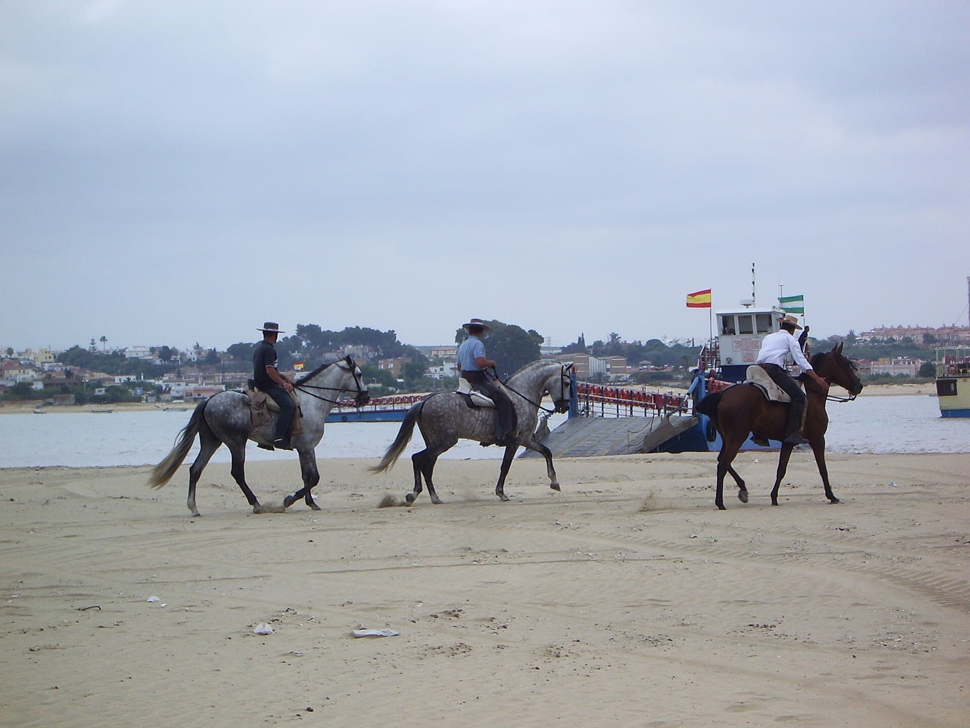
Pilgrims on horseback heading for the crossing point in Doñana
© Avicentegil · CC BY-SA 4.0

Camino de la Canaliega

Camino de Cádiz

The only route that crosses the Guadalquivir by barge, through the wildest heart of Doñana.

Distance
≈ 62 km
Days
3
Difficulty
Hard
Terrain
Marshland and dehesas of Doñana, unpaved

Access conditions

How, when and with what permits this way can be travelled throughout the year.

ModeStatus
On footAll year round
BicycleCheck conditions
On horsebackAll year round
VehicleRequires authorisation on the Doñana sections
CampingOnly in authorised areas
Fire riskSummer restrictions (INFOCA)

How to read the statuses

  • No restriction
  • !Conditions or permit apply (see each row)
  • Not allowed

The interior of the Parque Nacional de Doñana can only be travelled during the pilgrimage with the brotherhood or on authorised guided visits. Outside those cases, keep to the public tracks and waymarked trails.

Permits and regulations

Protected areas it crosses
Espacio Natural de Doñana (Parque Natural)Parque Nacional de Doñana
Competent authority
Junta de Andalucía (Consejería de Sostenibilidad y Medio Ambiente). Doñana is both a National Park and a Nature Park, a Biosphere Reserve and a UNESCO World Heritage Site.
Seasonal restriction
High fire-risk season (INFOCA Plan), usually from 1 June to 15 October: take extreme care with fire and bear in mind possible access restrictions.

Elevation profile

Ascent

+171 m

Descent

215 m

-940890 km18 km36 km54 km72 km

From the Bajo de Guía in Sanlúcar de Barrameda, the Cádiz brotherhoods cross the Guadalquivir by barge — an event in itself — and enter the stretch of Doñana considered the wildest and least travelled, through the old seigneurial dehesas, with long stretches without asphalt or any contact with towns.

Three days and two nights take the pilgrim from the river to the entrance over the La Canaliega bridge. Brotherhoods from farther away, such as the one from Jerez, add earlier stages before reaching Sanlúcar. Drought and the protection of Doñana mean the route has to be reviewed every year.

Who walks it

Cádiz, Jerez, Sanlúcar, El Puerto and the brotherhoods of Cádiz.

Day by day

The stages of the way

A representative division: each brotherhood sets its own schedule and rest stops, which vary each year depending on Doñana.

  1. 01 km

    Crossing of the Guadalquivir

    Jerez → Sanlúcar → La Marismilla

    From Santo Domingo in Jerez, the albariza vineyards give way to the marshland of Sanlúcar. The embarkation at Bajo de Guía — wagons and horses crossing the river by barge — is the crowning moment; on disembarking, one is already inside Doñana.

    Access

    On foot: All year roundBicycle: Check conditionsOn horseback: All year roundVehicle: Requires authorisation on the Doñana sectionsCamping: Only in authorised areasFire risk: Summer restrictions (INFOCA)

    Section through the interior of Doñana: travelled on foot or on horseback with the brotherhood; access by vehicle requires authorisation.

  2. 02 km

    Cerro del Trigo

    La Marismilla → Palacio de Doñana

    The toughest stage: hills of loose sand with no shade, on the most isolated stretch of all the Rocío routes. Only Doñana in its purest state — deer, wild boar, birds — until reaching the stately Palacio de Doñana at dusk.

    Access

    On foot: All year roundBicycle: Check conditionsOn horseback: All year roundVehicle: Requires authorisation on the Doñana sectionsCamping: Only in authorised areasFire risk: Summer restrictions (INFOCA)

    Section through the interior of Doñana: travelled on foot or on horseback with the brotherhood; access by vehicle requires authorisation.

  3. 03 km

    Entrance via La Canaliega

    Palacio de Doñana → El Rocío

    The final day: the landscape opens up and the emotion grows after two nights in the open. The crossing at La Canaliega — the Cádiz gateway to the village — is experienced with rockets, tinkling bells and cheers to the Virgin.

    Access

    On foot: All year roundBicycle: Check conditionsOn horseback: All year roundVehicle: Requires authorisation on the Doñana sectionsCamping: Only in authorised areasFire risk: Summer restrictions (INFOCA)

    Section through the interior of Doñana: travelled on foot or on horseback with the brotherhood; access by vehicle requires authorisation.

The route

The way on the map

An indicative route through its main landmarks. The ochre markers show towns with accommodation: tap to see hotels in the area.

LegendEl Rocío (destination)AccommodationDrinking waterBar / restaurant

Use two fingers to move the map; Ctrl + scroll to zoom. · Points from OpenStreetMap; check opening times and availability on site.

Download & offline navigation

Download the GPX track and open it in your hiking app (OsmAnd, Wikiloc, Locus…) to navigate without signal.

Download GPX

Where to sleep

Accommodation on each stage

Prices and availability for the pilgrimage · Pentecost, 16 de mayo de 2027

Affiliate links: booking through them costs you no more and helps keep this guide running.

Practical information

Getting there and back

Starting point
Jerez de la Frontera
Parking
Leave your vehicle in the town you set off from or in the village of El Rocío; the interior of Doñana has no open vehicle access.
Public transport
Public transport in the province of Huelva and the connection to El Rocío are operated by Grupo Damas. Check up-to-date routes and timetables before you travel. Buses (Grupo Damas)

All the ways end in the village of El Rocío (Almonte). As these are linear routes, arrange your return to the starting point before you set off: support vehicle, pick-up or bus.

Safety and emergencies

Useful numbers

  • 112Emergencies (general)
  • 061Medical emergencies (Andalusia)
  • 062Guardia Civil / SEPRONA (natural environment)

Recommendations

  • Walk early in the morning and late in the day, and avoid midday. Carry plenty of water, sun protection and a hat: in May the heat and the sand make the going much harder.
  • Mobile coverage is limited in the interior of Doñana. Download the GPX track to navigate offline and let someone know your route and timings.
  • During the fire-risk season (INFOCA Plan, from June to October) take extreme care with fire; in any emergency, call 112.

Frequently asked questions about access

Can the Camino del Rocío be walked outside the pilgrimage, even in winter?+

Yes. The ways run along drovers' roads and public tracks that are open all year round. Outside the pilgrimage they can be travelled on foot, on horseback and, on several sections, by bicycle. The best time is from October to May, as summer is very hot.

Do I need a permit to walk through Doñana?+

No permit is needed to walk along the public tracks and waymarked trails. Only the interior of the National Park, away from those tracks, requires access on an authorised guided visit; the pilgrimage with the brotherhood is the traditional exception.

Can it be travelled by bicycle or on horseback?+

On horseback, yes, on all the ways. By bicycle, along the public tracks and paths; on the sections that cross strictly protected areas it is best to check the conditions before setting off.

Is camping allowed along the way?+

Wild camping is not permitted in Doñana. You may only stay overnight in authorised areas and campsites, and, during the pilgrimage, in the places set aside by each brotherhood.

Other ways

See all
Download GPXBook